Scientific Diving
Background
Scientific diving is a core research method in marine ecology — a specialized form of scuba diving conducted under formal scientific training and institutional protocols to collect high-quality ecological data that cannot be obtained by remote or indirect methods. Scientific dives allow a researcher to be physically present in the habitat of the study organism, enabling direct observation of behaviors, biotic interactions, habitat context, and precise sampling of organisms and sediments in situ.
My work leverages scientific diving to generate high-resolution ecological data that underpin field studies on benthic community organization, interaction dynamics, spatial distributions, and ecosystem engineering in soft-sediment environments. Direct underwater observation and sampling are essential for understanding organism–environment relationships, validating interaction signatures, and contextualizing quantitative data collected from cores, transects, and quadrats.
Training and Qualifications
Scientific diving requires rigorous safety training, proficiency with specialized techniques, and continuous skill maintenance to manage the hazards of underwater research — including limited visibility, currents, entanglement risk, and heavy scientific equipment.
I am certified as:
- AAUS (American Academy of Underwater Sciences) Scientific Dive with a depth rating of 130 fsw (40 msw)
- TDI Technical Decompression and Trimix Diver
- NSS-CDS/ TDI/ NAUI Full Cave + Stage + DPV Diver
- NAUI Master Diver
These certifications provide the competence required to plan, conduct, and document scientific dives in a wide range of marine environments safely and effectively.
Methods and Field Techniques
My underwater research relies on standardized, quantitative sampling approaches designed to capture spatial structure, community composition, organism–environment relationships, and interaction signatures in soft-sediment ecosystems. These methods are implemented under AAUS scientific diving protocols and are adapted to sedimentary context, depth, and hydrodynamic conditions.
Quadrat sampling
Quadrat sampling provides high-resolution density and diversity
estimates within defined spatial units. Standardized quadrats are
deployed along transects or in stratified random designs to quantify
benthic macrofauna, infaunal emergence traces, and interaction
signatures. This method enables:
- Precise density estimates per unit area
- Fine-scale community composition analysis
- Microhabitat association studies
- Replication necessary for robust statistical inference
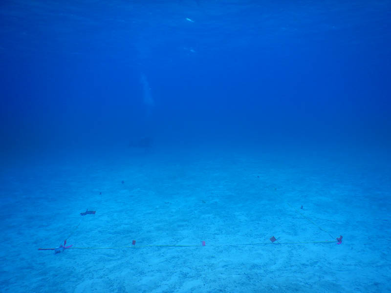
Transects
Transects provide spatially explicit data on species occurrence,
density, and interaction signatures across environmental gradients.
Transects are deployed perpendicular or parallel to sedimentary
features, reef margins, or depth contours depending on the
ecological question. This approach allows quantification of:
- Species distribution patterns across sediment types
- Diversity structure along depth or hydrodynamic gradients
- Variation in predation intensity or repair frequency
- Habitat transitions and patch boundaries
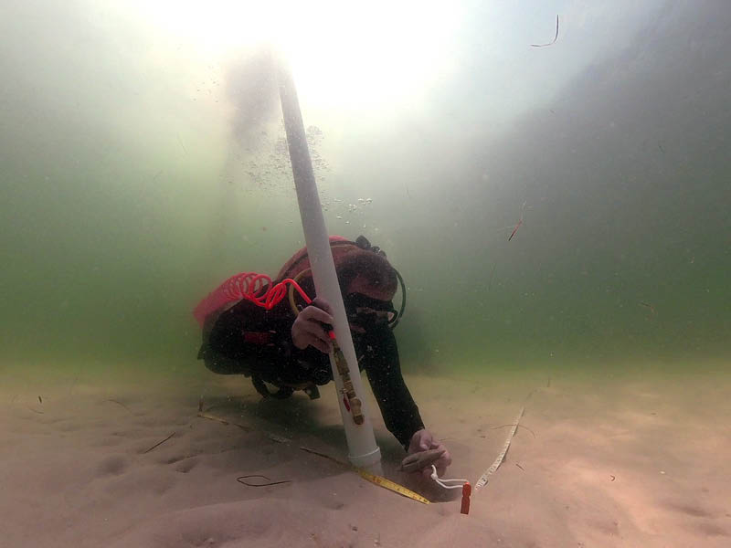
Airlift sampling
Airlift (underwater vacuum) systems are used to remove sediment in a
controlled, stratigraphically aware manner. Sediment is excavated
layer by layer and passed through mesh collection bags, allowing
recovery of buried macrofauna and skeletal remains while preserving
vertical context.
This method is critical for:
- Sampling infaunal echinoids and associated taxa
- Recovering sub-surface interaction traces
- Quantifying live–dead assemblage structure
- Maintaining sedimentological context for ecological interpretation
Airlift sampling is particularly effective in unconsolidated carbonate and siliciclastic substrates where manual excavation alone would disturb stratigraphy or reduce recovery efficiency.
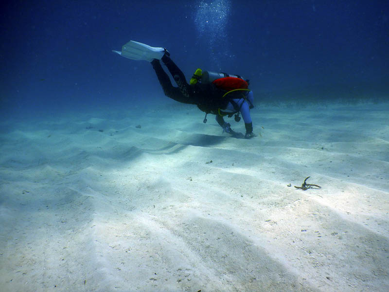
Sediment excavation and manual recovery
Targeted sediment excavation complements quadrat and airlift
approaches, allowing careful extraction of organisms and sediment
blocks for laboratory analysis. Manual recovery is essential when
working with fragile tests, delicate trace signatures, or
structurally intact specimens.
Excavation techniques are adapted to sediment compaction and grain size, ensuring minimal disturbance while maximizing ecological and taphonomic information.
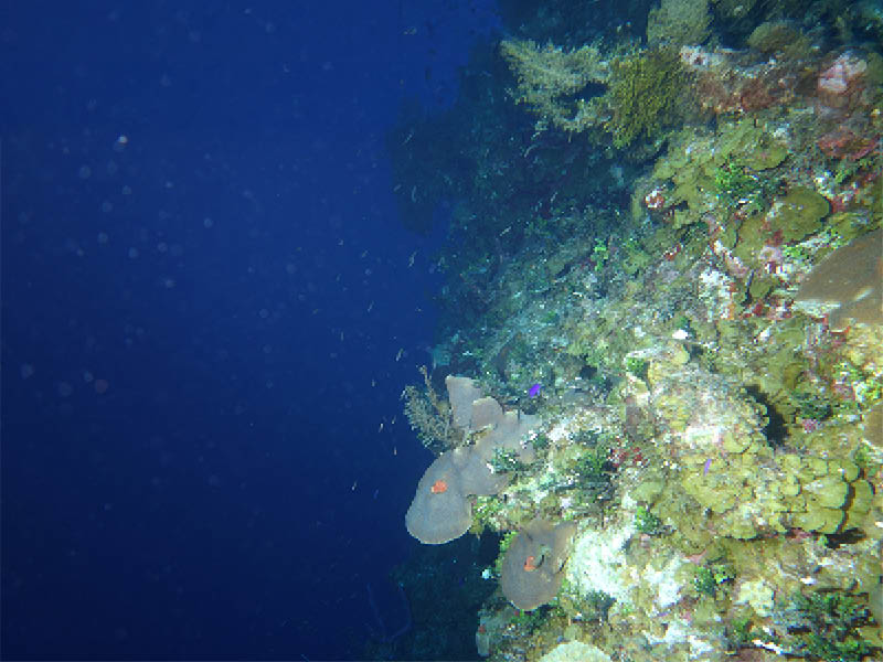
Deep wall explorations
As an AAUS-certified scientific diver with a 130 ft (40 m) depth
rating, I conduct ecological surveys along deep reef wall
environments. These habitats often represent transitional zones
where community structure can shift substantially relative to
shallow systems.
Deep wall dives enable:
- Assessment of depth-dependent species distributions
- Comparison of interaction intensity across vertical gradients
- Exploration of under-sampled benthic habitats
- Direct observation of habitat transitions and sediment stability
Working at these depths requires careful dive planning, gas management, and bottom-time optimization to balance safety with rigorous data collection.